Products & Services


Agriculture
YourMap - Static
The YourMap Static maps are hard copy maps in any size, in any way, completely customised. And of course, electronic copies are included. Check out our example map of a livestock property in rural Victoria.
We are specialists in Agricultural mapping, due to our farming background and beginning. The mapping could include, fence lines, contours, roads, hectarage, catchment sizes, watercourses, infrastructure, flood risk, fire risk, vegetation indexes, UAV data, etc. etc. all catered to the user.
Online maps compatible between all devices are also an option, scroll on to find out more.
With a wealth of government data available for any application.
Get in contact for information and pricing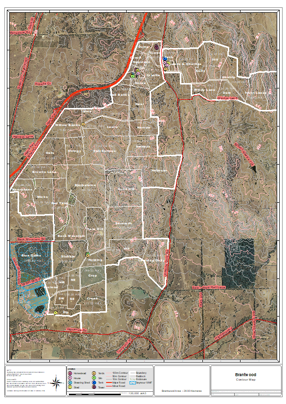
YourMap - Online/Google Earth
YourMap online is, at the moment, an addition to the static mapping, evolving around Geo-Assets for farming, primary production and industry. Check out our example, YourMap online, for a property in central Victoria. The online map has a number of measuring tools along with search bars and has the power to display any desired spatial information required.
There is also the option to present this data in Google Earth, if you already use Google Earth, this can be a powerful tool for planning.
In development, the next version of YourMap online will have a fully editable framework. Get in touch if you would like to know more.
Get in contact for information and pricing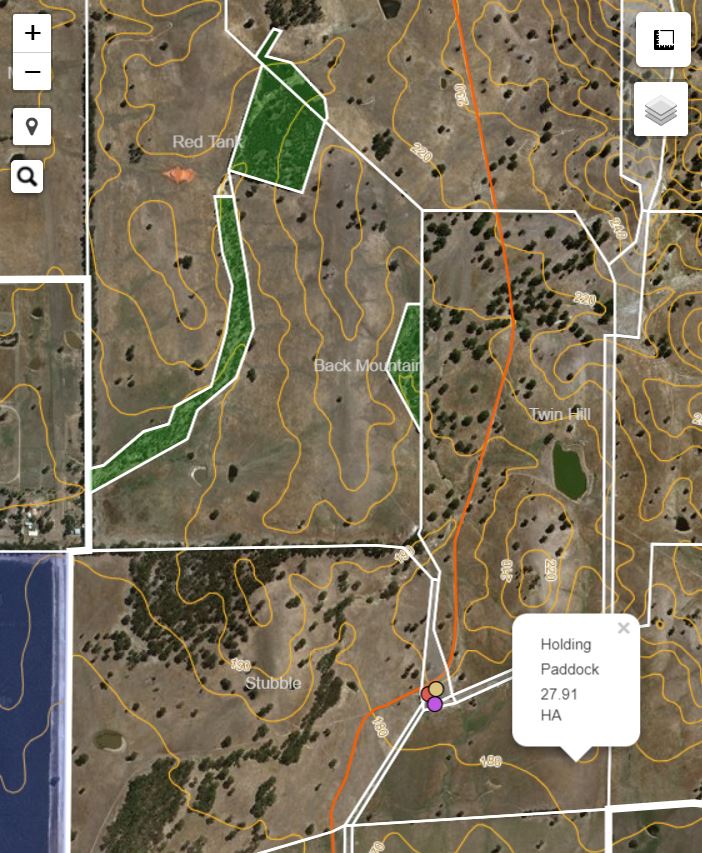
Environment & Infrastructure
YourMap - Static/Online
We also offer Geo-Asset mapping for Infrastructureprojects. With a wealth of government data for all applications. If you would like to know what government data we have available, you can find out here.
We also specialize in Environmental mapping. Providing top end environmental spatial analytics through our expert knowledge in GIS on areas of flooding, erosion, sea level rise and vegetation health. Check out the watershed map, used to estimate environmental flows from two tributaries.
Get in contact for information and pricing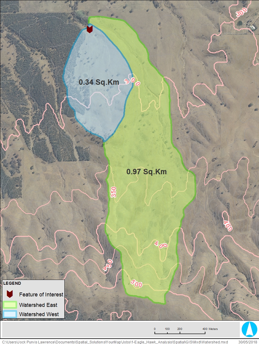
Spatial Data
YourMap - Spatial Data
Your one-stop-shop for all your spatial data needs, we have the resources and connections to collect all your spatial data for your project, so you can save time and money, and get all your spatial data in one spot.
The main government data-sets that we have access to are historical aerial imagery, government aerial imagery, government vector data (contours, infrastructure, waterways, planning zones, etc.), government grid data (LiDAR, elevation, etc.).
Get in contact for information and pricingYourMap - Spatial Workforce
Need short-term spatial data assistance in GIS, data management or mapping? Let us come work for you, hardware and software included
Get in contact for information and pricingYour Map Co.
Your Map Co. are specialists in spatial information, data and mapping
Copyright 2018 Your Map
All Rights Reserved